

Hurricane season tracker
Active Atlantic storms from the National Hurricane Center, the latest tropical outlook, Puerto Rico's hurricane history and a checklist to get ready.
Active storms in the Atlantic
The National Hurricane Center is not tracking any Atlantic tropical cyclones.
Source: NHC CurrentStorms feed, snapshot taken Nov 19, 10:28 PM AST. The site re-fetches it on every rebuild.
NHC tropical weather outlook
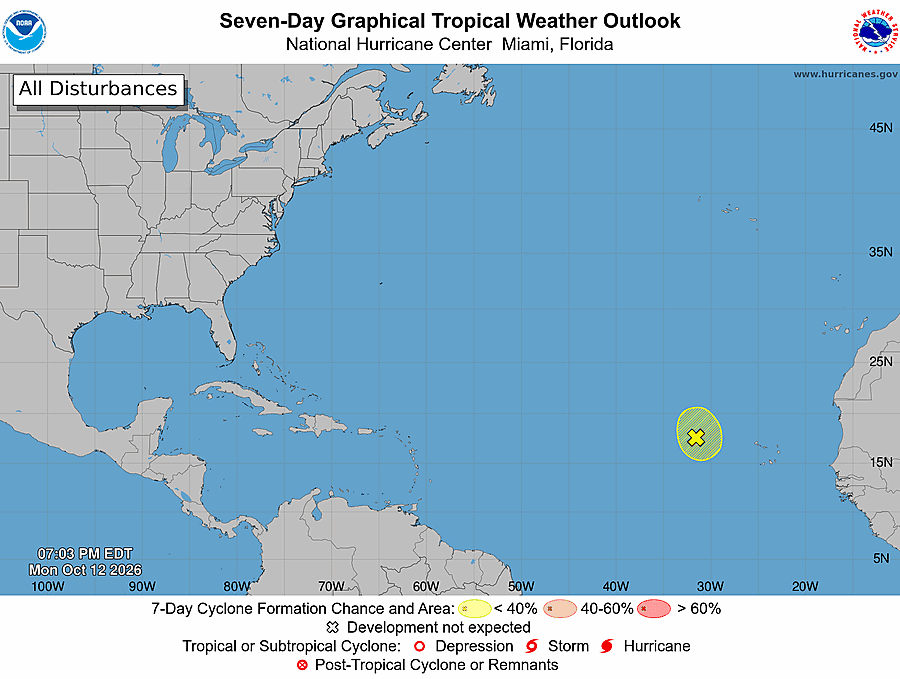
Tropical Weather Outlook
NWS National Hurricane Center Miami FL
700 PM EST Thu Nov 19 2026

For the North Atlantic...Caribbean Sea and the Gulf of America:

Offshore of the Southeast U.S. Coast:
Disorganized showers and thunderstorms extending across portions of
the Florida peninsula and the Bahamas are associated with a frontal
boundary. A non-tropical area of low pressure is forecast to form
along this boundary just east of the Florida peninsula, or over the
northern Bahamas, on Friday. This system could acquire subtropical
or tropical characteristics while it moves generally northward to
north-northeastward near or just offshore of the southeastern United
States coast through the weekend.

Regardless of tropical or subtropical development, the system is
expected to produce strong, gusty winds, dangerous surf, rip
currents and coastal flooding along portions of the southeast and
mid-Atlantic U.S. coasts into early next week. In addition, heavy
rainfall and the threat of flash flooding will continue across
portions of the Florida peninsula through Friday, potentially
spreading northward toward coastal portions of the Carolinas and the
mid-Atlantic over the weekend. Interests along the eastern coast of
the United States should continue to monitor the progress of this
system. Additional information on this system, including Gale
Warnings, can be found in High Seas Forecasts issued by the National
Weather Service, as well as products issued by your local National
Weather Service forecast office.
* Formation chance through 48 hours...low...30 percent.
* Formation chance through 7 days...medium...60 percent.

&&
High Seas Forecasts issued by the National Weather Service can be
found under AWIPS header NFDHSFAT1, WMO header FZNT01 KWBC, and
online at ocean.weather.gov/shtml/NFDHSFAT1.php
Issued Nov 19, 7:27 PM AST by the National Hurricane Center. Graphic: NHC, captured with the snapshot.
For decisions that affect your safety, use official sources. Watches, warnings and evacuation orders come from the National Hurricane Center, the National Weather Service in San Juan and Puerto Rico's emergency management bureau (NMEAD).
Hurricane prep checklist
Tick items off as you go. Your progress is saved in this browser only.
Water & food
Power & communications
Documents & money
Home
Health & family
Hurricanes that shaped Puerto Rico
Older storms carry the name of the saint's day on which they struck, a Puerto Rican tradition until the U.S. began naming storms in the 1950s.
| Year | Storm | What happened |
|---|---|---|
| 1928 | San Felipe II | Struck on September 13 as a Category 5, the strongest hurricane on record to make landfall in Puerto Rico. It went on to devastate Florida as the Okeechobee hurricane. |
| 1932 | San Ciprián | Crossed the island on September 26–27 as a major hurricane, destroying tens of thousands of homes. |
| 1989 | Hugo | Swept across Vieques, Culebra and northeastern Puerto Rico on September 18 as a major hurricane. |
| 1998 | Georges | Crossed the entire island from east to west on September 21, causing island-wide power loss and severe crop damage. |
| 2017 | Irma | Passed just north of the island on September 6 as a Category 5, cutting power to about a million customers. |
| 2017 | María | Made landfall near Yabucoa on September 20 as a high-end Category 4. It destroyed the power grid and the government's official death toll is 2,975. |
| 2022 | Fiona | Made landfall in the southwest on September 18 as a Category 1, but its torrential rain caused catastrophic flooding and another island-wide blackout. |
Sources: NOAA National Hurricane Center reports and HURDAT2; Government of Puerto Rico (María death toll, based on the George Washington University study, 2018).