Puerto Rico has many places to visit, including multiple UNESCO World Heritage Sites.
The first Spanish settlement was built in 1508 near Old San Juan. Since then, Puerto Rico has developed into a unique destination that welcomes millions of visitors each year.
I was born in Puerto Rico, and have traveled extensively across the island.
In this article, I will cover the 45 best destinations, attractions and places to visit in Puerto Rico.
1. El Morro, San Juan
Located at the northwestern most point of Old San Juan.
The Castillo San Felipe del Morro — better known as “El Morro”, is one of the most popular places to visit in Puerto Rico.
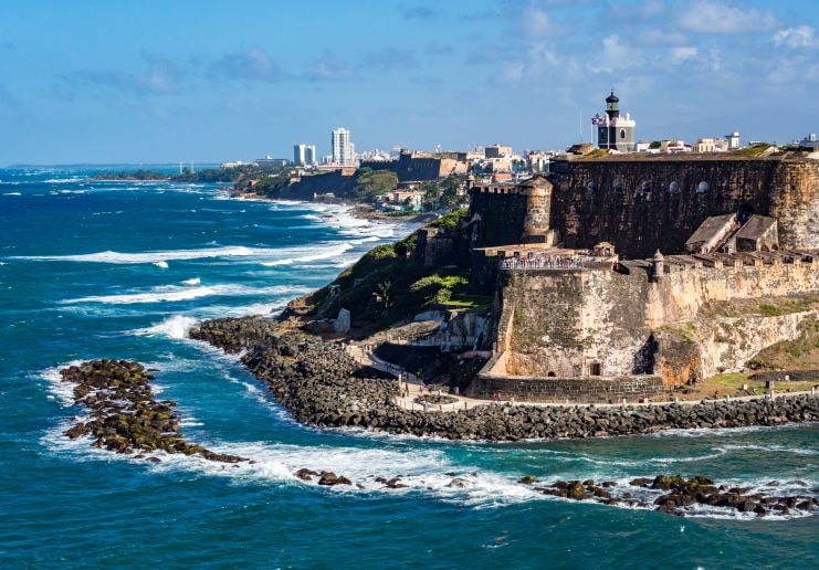
The iconic fortress is permeated with 500 years of ancient and modern history and is one of the National Monuments of Puerto Rico.
Below is a Google Map that shows the location of El Morro:
Learn more in our article El Morro – All You Need To Know.
2. Paseo de la Princesa, San Juan
You can’t leave San Juan without taking a stroll through this picture-perfect promenade.
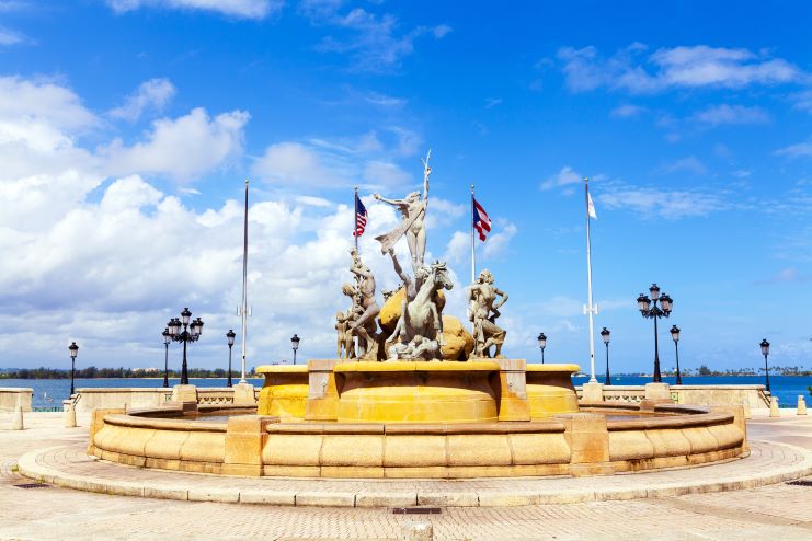
Adorned with beautiful lamp posts and striking fountains, El Paseo de la Princesa is one of the most historically renowned landmarks of the island.
Below is a Google Map that shows the location of Paseo de la Princesa:
Learn more by reading our article Paseo de la Princesa – All You Need To Know.
3. Calle San Sebastian, San Juan
Famous for holding Puerto Rico’s largest festival.
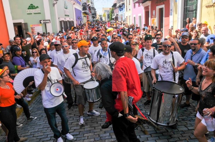
Filled with music and joy, Calle San Sebastian is full of restaurants and bars where you can appreciate a lot of Puerto Rican culture and customs.
Below is a Google Map that shows the location of Calle San Sebastian:
Learn about more activities in San Juan in our article 40 Best Things To Do In San Juan.
4. Las Sombrillas Exhibit — Calle Fortaleza, San Juan
You’ll love the whimsical look of the hanging umbrellas in Calle Fortaleza.
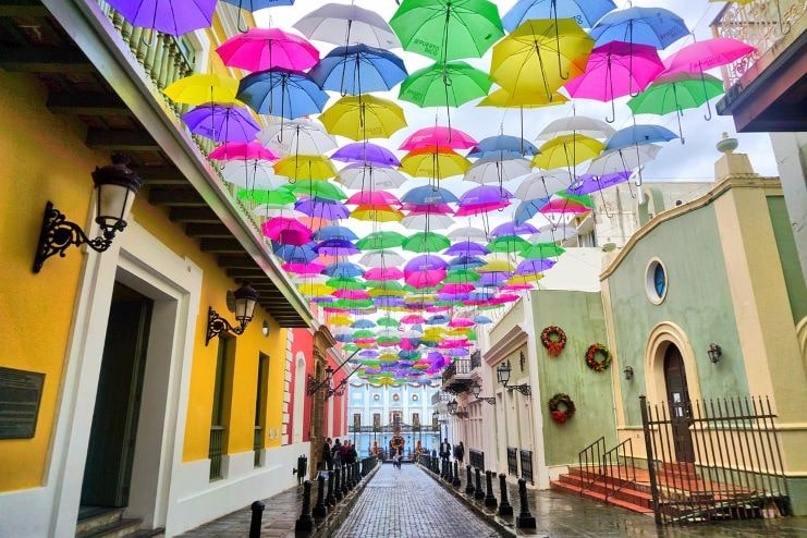
Visit this colorful exhibit and take a walk through the cobblestone street admiring the beautiful architecture of the adjacent shops and restaurants.
Below is a Google Map that shows the location of Calle Fortaleza:
Learn more in our article Old San Juan – All You Need To Know.
5. La Perla, San Juan
The most scenic neighborhood of Old San Juan.
Located near El Morro, La Perla (The Pearl) is the go-to night spot for people of all ages.
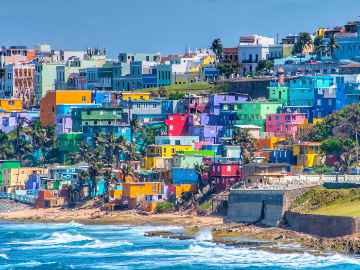
Visit its small rustic bars and enjoy a night of dancing and singing in La Perla.
Below is a Google Map that shows the location of La Perla:
6. Plaza del Quinto Centenario (Quincentennial Plaza), San Juan
The Quincentennial Plaza is located at the northern point of Old San Juan.
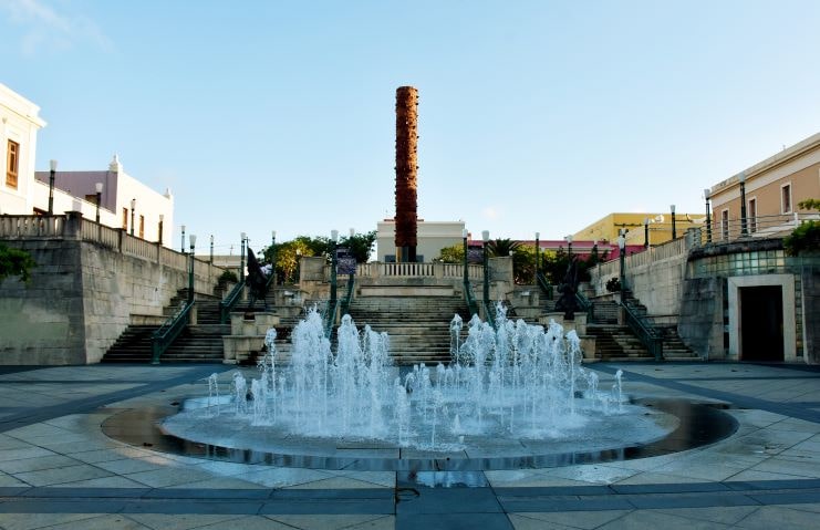
Meant as the symbol of the new world, a 40-foot-tall tower stands tall in the middle of this commemoration of Columbus’s first voyage to the Americas.
Below is a Google Map that shows the location of Plaza del Quinto Centenario:
7. El Yunque Rainforest, Rio Grande
Home to over 240 tree species, El Yunque is rich in flora and fauna.
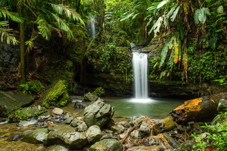
Explore its hiking trails and magnificent waterfalls of the only tropical rainforest of the National Forest System.
Below is a Google Map that shows the location of El Yunque National Forest:
Read more in our article about El Yunque – All You Need To Know.
8. Flamenco Beach, Culebra
Even for the locals, Flamenco Beach is the perfect getaway.
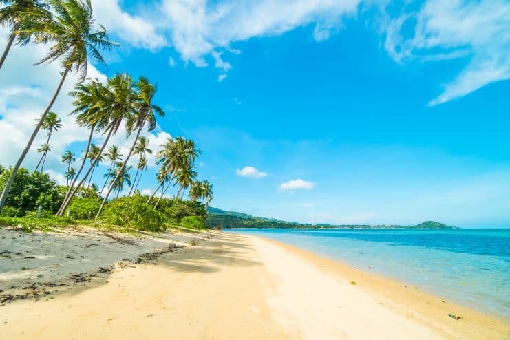
Complete with white-sand beaches and waveless cerulean water, Flamenco Beach lives up to its reputation as one of the best beaches in the world.
Below is a video touring Culebra:
Flamenco Beach is Located on the Island of Culebra, 20 miles off the coast of Fajardo.
Below is a Google Map that shows the location of Flamenco Beach:
Read more in our article Flamenco Beach – All You Need To Know.
9. La Placita, Santurce
La Placita de Santurce is another historical landmark of Puerto Rico.
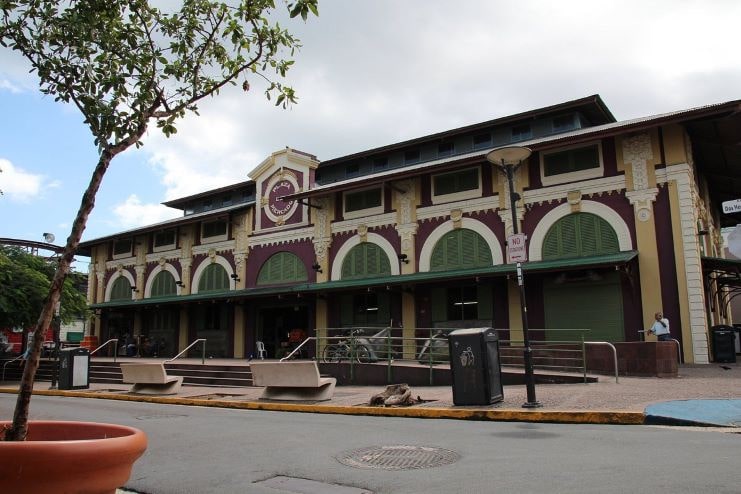
But you should know that La Placita has a split personality!
During the day La Placita is a marketplace, but after sunset, it turns into one of the most popular party places where patrons go to restaurant/bar hopping.
Below is a Google Map that shows the location of La Placita:
10. La Guancha, Ponce
The picturesque seafront boardwalk of the south.
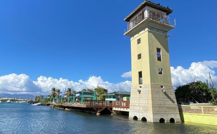
Take a stroll along La Guancha’s kiosks and restaurants and enjoy the Caribbean flavor of cocktails and food.
Below is a Google Map that shows the location of La Guancha:
Learn more about the area in our article Ponce – All You Need To Know.
11. Charco Azul river, Vega Baja
Cave diving in Charco Azul is a must-do!
View this post on Instagram
Photo Credit: @alex_78
This hidden gem includes a breathtaking view that you can enjoy while swimming in the lake.
Below is a Google Map that shows the location of Charco Azul:
12. Rio Blanco Campground, Naguabo
A camping ground to relax.
View this post on Instagram
Photo Credit: @alex_78
If you are looking to connect with nature and relish the impressive views all around you, Rio Blanco Campground is what you’re looking for.
Below is a Google Map that shows the location of Rio Blanco Campground:
13. T-Mobile District
T-Mobile District is an entertainment setting.
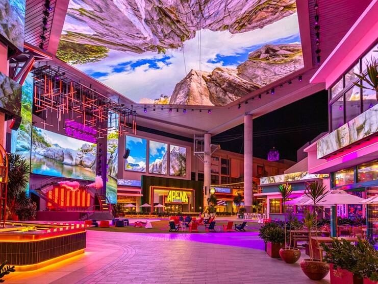
There is no other place in Puerto Rico where you can watch a movie, enjoy a delicious meal in a fine restaurant, catch a concert, and zipline all in one place!
Below is a Google Map that shows the location of the T-Mobile District:
14. Mar Chiquita, Manatí
This jellyfish-shaped natural pool is one of a kind.
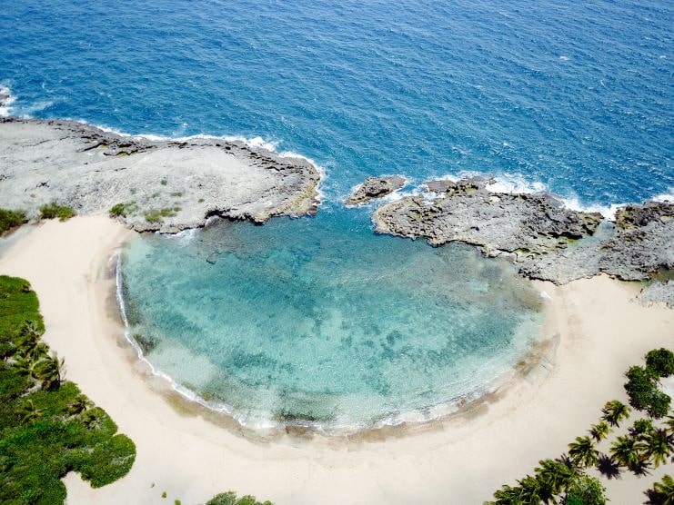
Visit Mar Chiquita and relax in aquamarine waters while trying a delicious Puerto Rican fish taco.
Below is a Google Map that shows the location of Mar Chiquita Beach:
15. La Playuela (Playa Sucia), Cabo Rojo
One of the most popular beaches in the southwest.
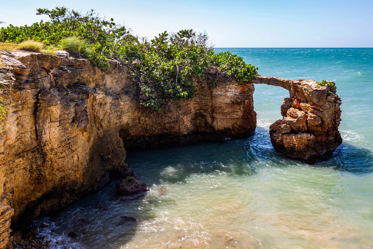
Visit this natural wonder and you will get a perfect tan while admiring the majestic view.
Below is a Google Map that shows the location of Playa Sucia:
16. Crash Boat Beach, Aguadilla
Crash Boat Beach is known as the island’s party beach.
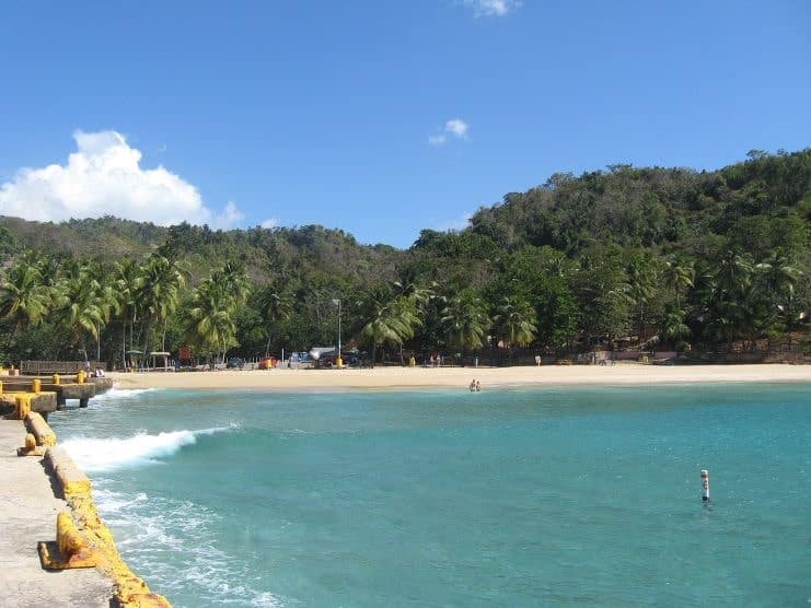
The water is excellent for swimming and snorkeling, and the sand is great for dancing as you jump from one kiosk to another.
Below is a Google Map that shows the location of Crash Boat Beach:
Read more about Crash Boat Beach here.
17. Castillo Labadie, Moca
El Castillo Labadie is one of the historical landmarks of the island.
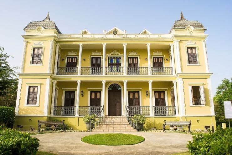
Take a tour of this century-old structure and learn about Puerto Rico’s culture and history.
Below is a Google Map that shows the location of Castillo Labadie:
18. Luquillo Kiosks, Luquillo
Only 11 minutes from the El Yunque Rainforest.
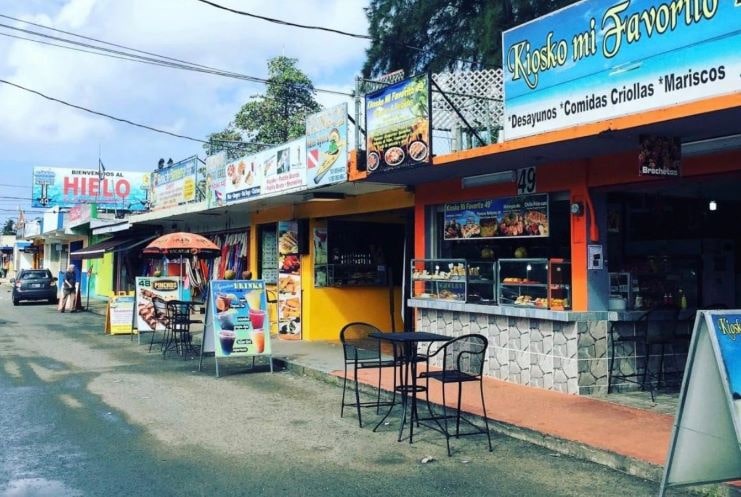
Walk through this row of over 50 kiosks where you can eat all kinds of seafood, enjoy refreshing drinks, and buy beautiful souvenirs.
Below is a Google Map that shows the location of Kioskos de Luquillo:
Learn more in our article Luquillo – All You Need To Know.
19. Balneario La Monserrate, Luquillo
Located just steps from the Luquillo kiosks.
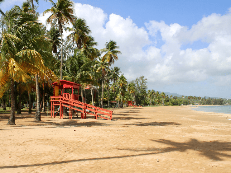
This beautiful beach includes camping and picnic areas as well as bathrooms and showers.
Below is a Google Map that shows the location of Monserrate Beach:
Read more in our article about Luquillo Beach.
20. La Parguera, Lajas
La Parguera is a waterfront block located in the southwest of Puerto Rico.
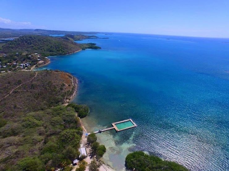
Walk through its streets sipping a refreshing Mojito Beach while enjoying the festive atmosphere.
Below is a Google Map that shows the location of La Parguera:
Later at night you can swim or snorkel in its bioluminescent bay.
Learn more by reading our article Puerto Rico’s Bioluminescent Bays.
21. Poblado, Boquerón
One of the most popular weekend destinations.
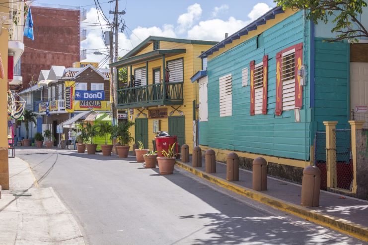
Located in the southwest of Puerto Rico, this fishing village is lined with restaurants where you can enjoy the best tropical seafood.
Below is a Google Map that shows the location of Poblado de Boquerón:
22. Casa Bavaria, Morovis
Beautiful restaurant with a striking view.
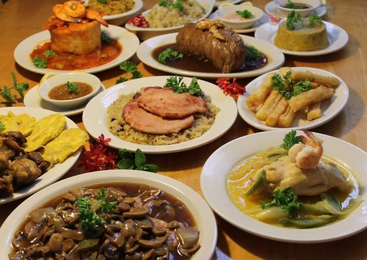
You will not find another place in the world where you can have mofongo and schnitzel in the same place.
Below is a Google Map that shows the location of Casa Bavaria:
View their menu here.
23. La Cara del Indio, Isabela
This imposing rock sculpture is located at the entrance of the town of Isabela.
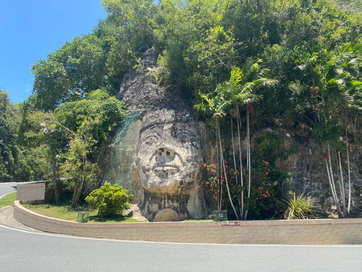
This monument was carved in honor of Cacique (Chief) Mabodamaca, who fought fearlessly to protect his people during the Spanish and European invasions.
Below is a Google Map that shows the location of Cara del Indio:
24. Playa Peña Blanca, Aguadilla
A perfect-picture beach.
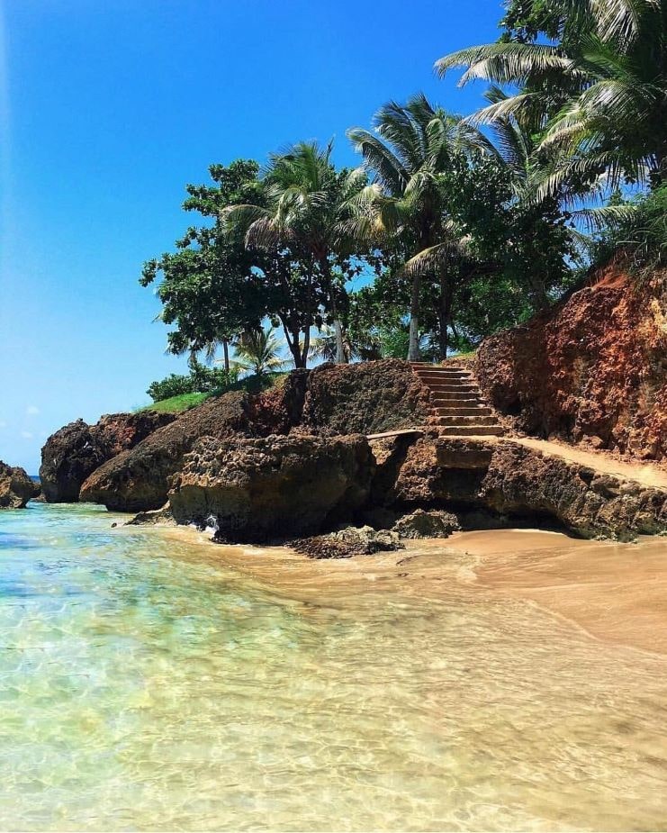
This secluded beach is a captivating natural scenery.
If you want to relax you will enjoy the serene waters during summer, but if surfing is your thing best to visit during winter.
Below is a Google Map that shows the location of Peña Blanca Beach:
Learn more by reading our article Peña Blanca Beach – All You Need To Know.
25. Toro Verde Adventure Park, Orocovis
This adventure park holds one of the longest ziplines in the world.
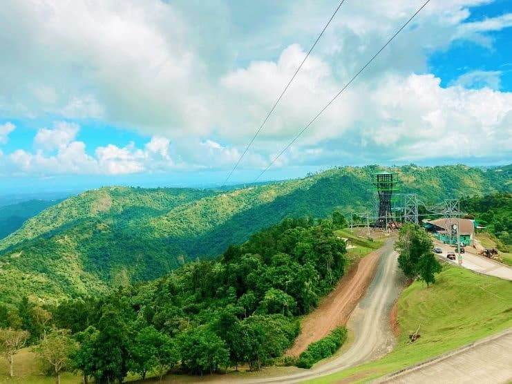
If you are an adrenaline junkie come and fly over one of the most amazing forests at over 90 mph.
“The Monster” is a 1.5-mile-long zip line and the main attraction of Toro Verde Adventure Park.
Below is a Google Map that shows the location of Toro Verde Adventure Park:
Learn more in our article 12 Best Zipline Adventure Parks In Puerto Rico.
26. Cerro de Nandy, San Lorenzo
This restaurant sits at the top of a hill!
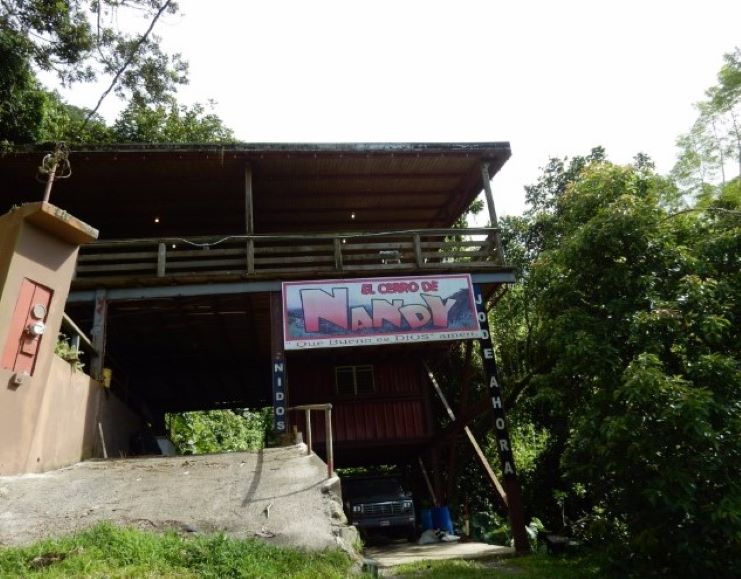
Go up the hill on their 4×4 truck and enjoy a delicious meal while admiring hundreds of miles of splendid forests.
Below is a Google Map that shows the location of El Cerro de Nandy:
Get more information by visiting the Cerro de Nandy Facebook page.
27. Cavernas de Camuy National Park, Camuy
Explore this cave system of over 10 miles of wondrous caverns.
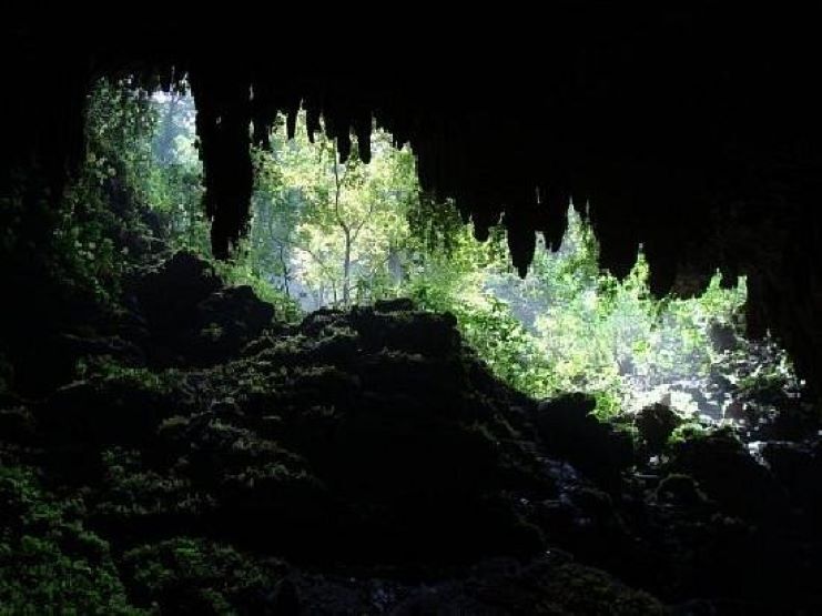
Take the Rio Camuy Cavern Tour and discover more than 200 caves and the third-largest underground river in the world.
Below is a Google Map that shows the location of Cavernas del Rio Camuy National Park:
Learn more in our article 12 Best Caves In Puerto Rico.
28. Caguana Indigenous Ceremonial Site, Utuado
Learn about Puerto Rico’s indigenous culture.
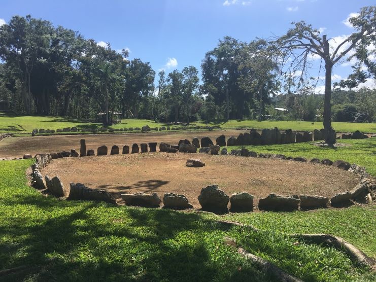
The Caguana Indigenous Ceremonial Site is the Caribbean’s most important archaeological site. It preserves numerous monoliths and petroglyphs of the indigenous inhabitants of Puerto Rico.
Below is a Google Map that shows the location of the Caguana Ceremonial Indigenous Heritage Center:
29. Museo de Arte Contemporáneo de Puerto Rico, Santurce
Enjoy the exhibits of contemporary art of Puerto Rico’s community.
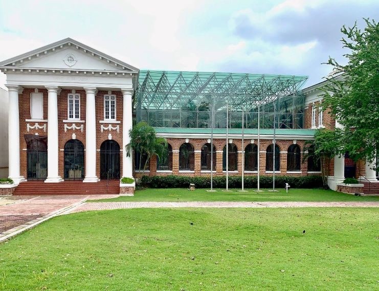
The Museo de Arte Contemporáneo (MAC) cultivates a new view of contemporary art.
Below is a Google Map that shows the location of Museo de Arte Contemporáneo de Puerto Rico:
Learn more on the museum’s website.
30. Mirador de Guajataca, Quebradillas
This lookout point presents the most amazing views of the north coast.
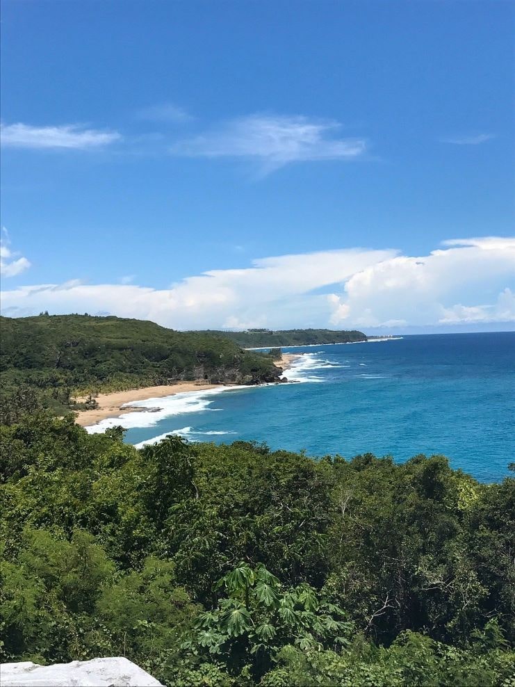
Don’t forget your camera!
Below is a Google Map that shows the location of Mirador de Guajataca:
Learn more in our article Mirador de Guajataca – All You Need To Know.
31. Carabalí Rainforest Adventure Park (Hacienda Carabaí), Luquillo
This adventure park/ranch is loaded with activities for the whole family.
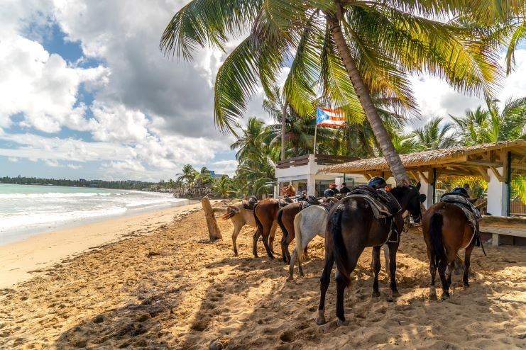
Visit Hacienda Carabalí and spend the day horseback and ATV riding.
You can also enjoy their mouth-watering steaks and seafood.
Below is a Google Map that shows the location of Hacienda Carabalí:
Visit the Carabali Rainforest Park website to learn more.
32. Puente Hamaca, Adjuntas
Visiting the Hamaca bridge of Garza Lake is a unique family adventure.
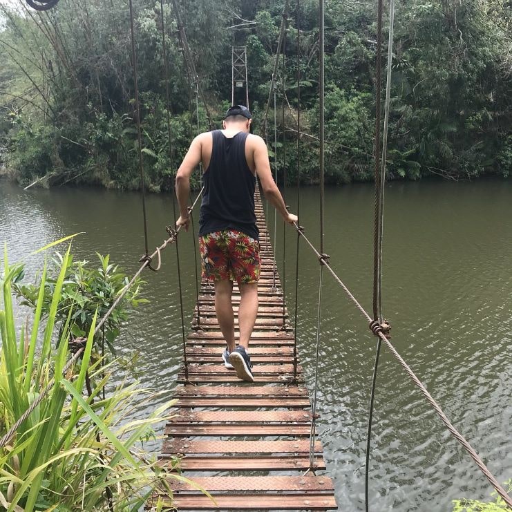
Puerto Rico is full of beautiful forests and landscapes and Puente Hamaca is visually captivating.
Below is a Google Map that shows the location of Puente Hamaca:
33. Museo de Arte, Ponce
This renowned museum includes over 4,500 works of art.
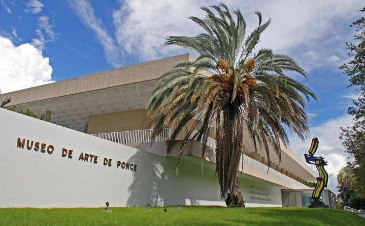
The Museo de Arte de Ponce includes sculptures, paintings, photographs, and Puerto Rican folk art that dates from the IX century.
Below is a Google Map that shows the location of Museo de Arte de Ponce:
Note: As of late 2022, the main galleries of Museum of Art of Ponce are currently closed for renovations.
Contact [email protected] or call 787-840-1510 for the most current information.
34. Piñones, Loiza
This ocean drive is lined with kiosks where you can enjoy Puerto Rican cuisine.
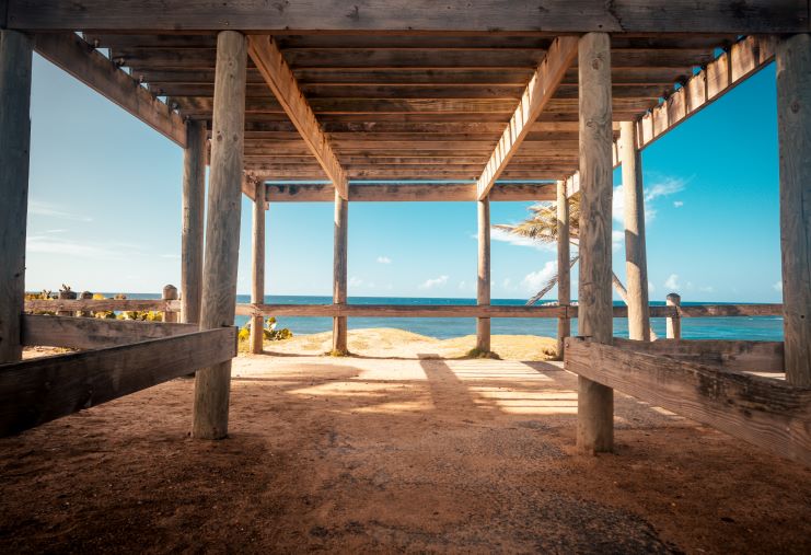
Try the best food and drinks in Puerto Rico hopping from kiosk to kiosk while enjoying a day on the beach.
Below is a Google Map that shows the location of Playa Piñones:
Learn more about the 30 Best Puerto Rican Street Foods.
35. Las Croabas, Fajardo
This park sits in front of the Fajardo bioluminescent bay.
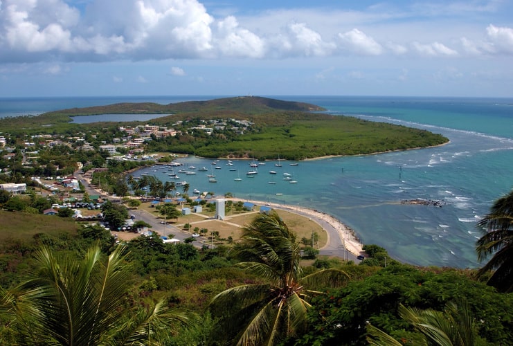
Surrounded by restaurants, Las Croabas is the departing point of many kayaking tours.
Below is a Google Map that shows the location of Las Croabas:
Learn more about the area in our article Fajardo – All You Need To Know.
36. Playa Jobos, Isabela
This beach is one of the summer favorites.
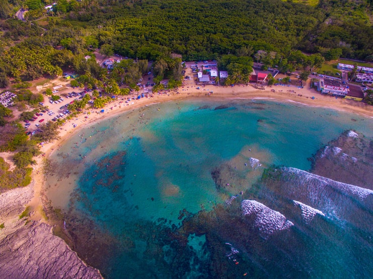
Ideal for surfing and paddleboarding, this arch-shaped beach is surrounded by bars and restaurants.
Below is a Google Map that shows the location of Playa Jobos:
Learn more about the area in our article Isabela – All You Need To Know.
37. Plaza de las Delicias, Ponce
Visit the main Plaza of Ponce.
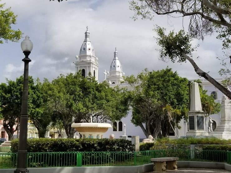
Located in the center of the town of Ponce this plaza includes many historic buildings like the Parque de Bombas and Teatro Fox.
Below is a Google Map that shows the location of Plaza Las Delicias:
38. Castillo Serrallés, Ponce
Take a tour of Castillo Serrallés Museum.
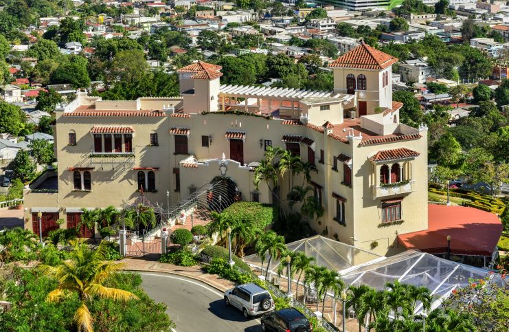
Learn the history of rum in Puerto Rico in a guided or virtual reality tour.
This setting is also perfect for weddings and social events.
Below is a Google Map that shows the location of Museo Castillo Serrallés:
39. Vieques National Wildlife Refuge, Vieques
This wildlife refuge contains more than 17,000 acres of land.
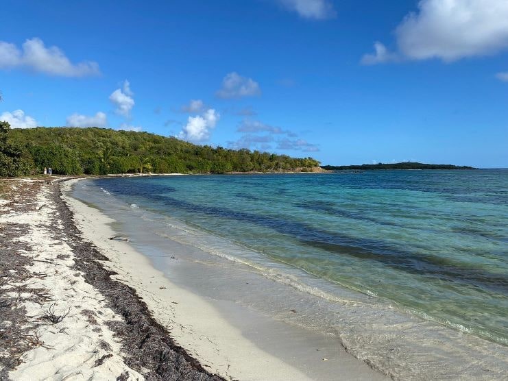
Learn about endangered plants and animals like the Calyptranthes Thomasiana and the Antillean Manatee.
Below is a Google Map that shows the location of Vieques National Wildlife Refuge:
To learn more in our article Vieques – All You Need To Know.
40. Black Sand Beach (Playa Negra), Vieques
Black Sand Beach (Playa Negra) is one of the most unique beaches in Puerto Rico.
This beach has dark black sand.
If you go to Vieques island you can’t skip visiting this beach.
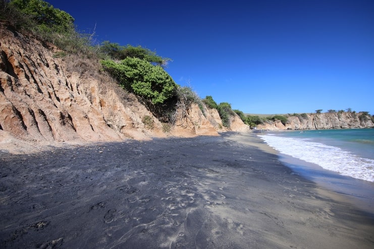
During heavy rains, volcanic material washes down and ends up at this beach creating a stunning effect.
Below is a Google Map that shows the location of Black Sand Beach:
41. Toro Negro State Forest, Orocovis
This extensive forest is the perfect venue for hikers.
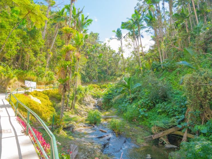
More than 10 miles of trails, natural pools with waterfalls, and mesmerizing views.
Below is a Google Map that shows the location of Toro Negro:
42. Plaza Colón, Mayagüez
Another historical landmark.
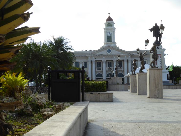
Visit this 182-year-old town square and enjoy its monuments, and statues and learn the history behind them.
Below is a Google Map that shows the location of Colón Plaza:
43. Isla Verde, Carolina
At only three minutes from SJU airport the most popular beach in the metro area.
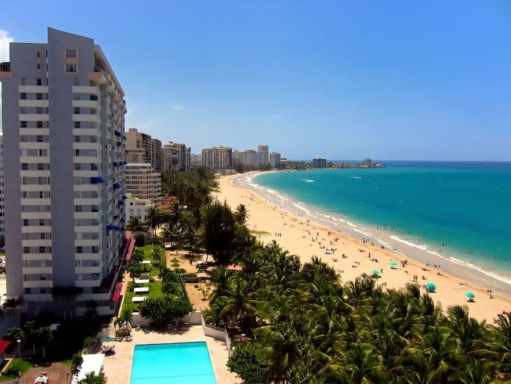
This 3-mile-long beach is surrounded by hotels, restaurants, and fast food venues.
Below is a Google Map that shows the location of Isla Verde:
44. Condado, San Juan
This luxurious oceanfront has been the setting of many Hollywood movies.
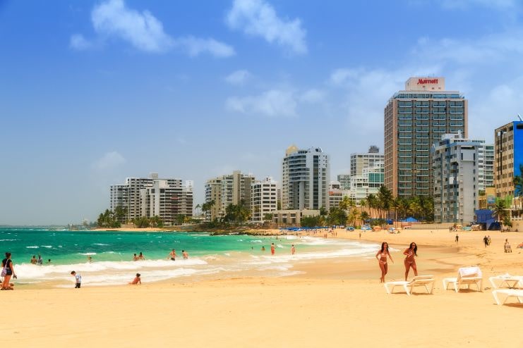
Condado is the heart of the nightlife of the metro area.
Hotels, casinos, exclusive shops, nightclubs, and restaurants define the area.
Below is a Google Map that shows the location of Condado:
Learn more by reading our article about Condado.
45. Casa Bacardí Tour, Cataño
The largest rum distillery in Puerto Rico.
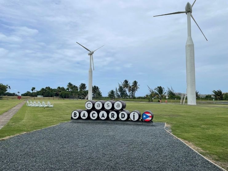
Take a guided tour and learn the history of rum Bacardi.
Activities include a virtual mixology class.
Below is a Google Map that shows the location of Casa Bacardí:
FAQ section
Where should I visit in Puerto Rico?
The best areas to visit in Puerto Rico are San Juan for touring, Culebra for the best tan, Isabela for surfing, Orocovis for adrenaline junkies, and Lajas to see the bioluminescent bay.
What is the prettiest place in Puerto Rico?
Not even the locals can agree on which is the prettiest place in Puerto Rico. El Yunque and Flamenco Beach are good places to start.
What part of Puerto Rico is most popular?
The Metro area is the most popular, and known as the center of everything.
What is a popular site in Puerto Rico?
San Juan is the most popular place to visit for tourists and locals alike.
Final thoughts
If you are visiting the San Juan metro area, Old San Juan and Condado are great places to explore.
Cabo Rojo, Culebra, and Vieques offer some of the more secluded beaches.
For hikers and outdoor explorers, don’t miss El Yunque and ziplining opportunities.
I also recommend that you check out the bioluminescent bays that Puerto Rico has to offer.

