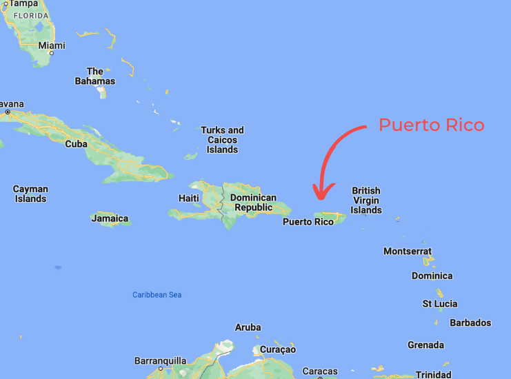
When you see it on the map, Puerto Rico seems like a small island.
But, Puerto Rico is not just an island, it is an archipelago; three inhabited islands and several uninhabited islands comprise the islands of Puerto Rico.
I have been taking tourists to the islands of Puerto Rico for almost 20 years.
In this article, I will cover every major island in Puerto Rico:
– Puerto Rico – Main Island
– Vieques Island (Isla de Vieques)
– Culebra
– Culebrita
– Isla Cardona
– Palominito
– Icacos
– Caja de Muertos
– Mona
– Gilligan’s Island
– Mata La Gata
– Desecheo Island
Puerto Rico – Main Island
You will find Borikén (The Island of the Brave and Noble Lord,” as the Taino Indian called it) 1,067 miles southwest of the Florida Keys.
Puerto Rico is a commonwealth of the United States. You don’t need a passport or currency change to travel to this non-incorporated US Territory.
The United States Federal Constitution, Rights, and Laws apply to Puerto Rico. Spanish and English are Puerto Rico’s official languages.
Even your cell phone will work in Puerto Rico, and you will get no roaming charges because all of the major cell phone companies do business in Puerto Rico.
You will be safe and protected and have no communication problems in Puerto Rico.
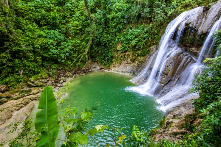
The main Island has a tropical rainforest and a dry forest.
Sandy beaches with turquoise water under bright blue skies await you in Puerto Rico.
You can swim in rivers and visit waterfalls in Puerto Rico.
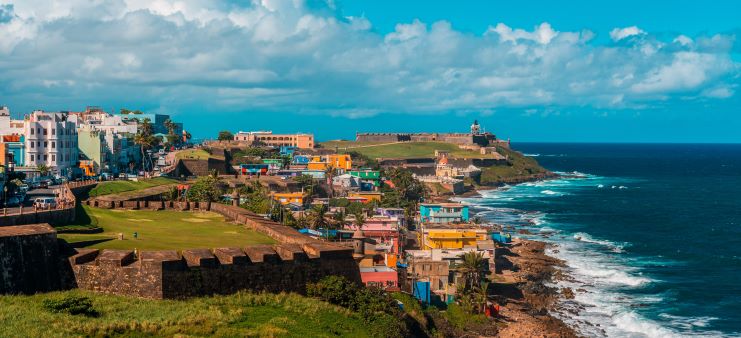
San Juan, the Capital City of the island, has a walled portion (Old San Juan) that is over 500 years old.
History enthusiasts will find many historical sites to visit in Puerto Rico.
From Surfing (on the west coast) to kayaking, snorkeling, to paddle boarding, you can practice every water sport in Puerto Rico.
You can travel to Puerto Rico from most major United States cities. It is only a two and half hour’s flight from Orlando, Florida.
Puerto Rico is worth visiting; you will find everything for everyone in this tropical paradise.
PuertoRico.com is the complete site for tourism in Puerto Rico.
Check out our guide to the 45 Best Things To Do In Puerto Rico.
Vieques Island (Isla de Vieques)
“La Isla Nena” (the girl island) or Bieké (small land), as the Taino called it, is just 21 miles long by only 3 miles wide.
Vieques is famous for many things; let’s explore some of them:
Historians say South American Indians arrived in Vieques 1,500 years before Christopher Columbus “discovered” Puerto Rico in 1493.
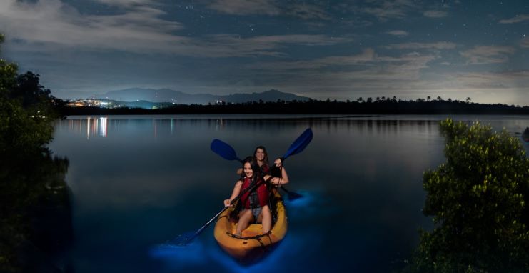
Mosquito Bay, the brightest bioluminescent bay in the world, is in Vieques.
One of the first things you will see in Vieques is horses roaming free.
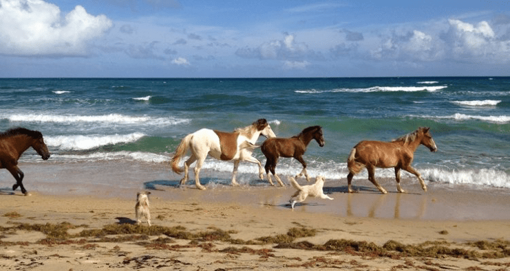
Many locals own horses and let them free during the day.
Vieques is famous for the role it played in US Defense.
The US Navy used the Island of Vieques for target practice for over sixty years. They left Vieques in May 2003.
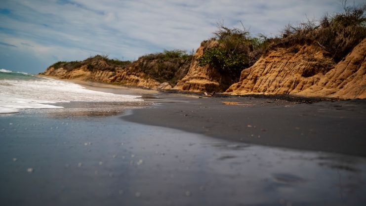
Playa Negra (Black Beach) is a black sand beach in Vieques.
You can snorkel, scuba dive, or relax on the beach in Vieques.
Those of you who like rum can visit Crab Island Rum Distillery or taste Vieques’ bilí (a rum made with “quenepa” Spanish Lime (Melicoccus bijugatus).
In Vieques, you can have excellent seafood. If you have the opportunity to visit Vieques, you will enjoy it!
Here’s a video of things to do in Vieques:
Vieques is just eight nautical miles from The Main Island’s East Coast.
Check out the location of Vieques on the Google Map below:
For more information, read our article on the 30 Best Things to Do in Vieques.
Culebra
La Isla de Culebra, or Snake Island, is the smallest inhabited Island in the Puerto Rican Archipelago.
Culebra is just 7 miles long by 3.5 miles wide.
It is famous for its beaches, but Flamenco Beach stands out as one of the best beaches in the world, according to Conde Nast Traveler.

You can also kayak, scuba dive, or snorkel with sea turtles in Culebra. Culebra’s slow-paced way of life will help you “disconnect” from the rush of daily life.
Public transportation is almost inexistent in Culebra, and we recommend renting a four-wheel drive vehicle.
This small Island is 17 miles west of Puerto Rico’s main Island and 12 miles west of Saint Thomas.
To get to Culebra from San Juan, you have two options: fly from SJU Airport Culebra or drive to Ceiba and take the Ferry.
The flight from San Juan to Culebra will take about half an hour, and the ferry ride will take close to 35 minutes.
There are no direct ferries from San Juan to Culebra; the ferry leaves from Ceiba, an hour and a half drive from San Juan.
Below is a Google Map that shows the location of Culebra:
Culebra is worth visiting; the beaches and the wildlife are spectacular, and Los Culebrenses (the people from Culebra) are hard-working, noble people that will treat you like you’re one of them.
Check out our guide to the 25 Best Things To Do In Culebra for more.
Culebrita
Culebrita is a one-mile long by one-mile wide small uninhabited island west of Culebra.
The little Island is a natural reserve; conservational laws protect the animals and plants of Culebrita.
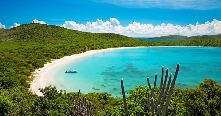
Most people don’t know this, but Culebrita is the star of puertorico.com.
Our main photo, the one with boats and yachts on a pristine beach, is from Culebrita.
Culebrita is famous for its beaches; it has 6, an old Spanish lighthouse, and tidal pools on the rocks.
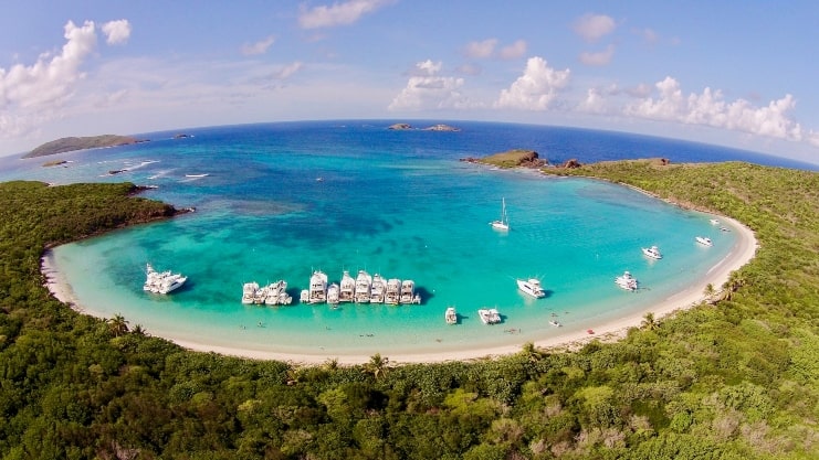
In Playa Tortuga (Turtle Beach), you will swim and snorkel with turtles that are not shy or scared of humans.
A 25-minute hike will take you to the lighthouse.
The view from there is impressive.
Below is a video of a day in Culebrita:
Getting to Culebrita is a challenging task; first, you have to go to Culebra and, from there, charter a private boat that will be inexpensive.
Most of those charters include chairs, umbrellas, and food and refreshments.
One thing that people visiting Culebrita agree on is that the trip is worth it.
You will have a small paradisiac island for yourself for a day.
Below is a Google Map that shows the location of Culebrita:
Check out our article 30 Best Beaches in Puerto Rico for a comprehensive list of Puerto Rican Beaches.
Isla Cardona
Sometimes called Sister Isolina’s Ferrer Island, Isla Cardona is an eight acre small island just 1.3 nautical miles from Ponce Bay.

It is famous for its 1889 Lighthouse, listed in the United States Registry of Historic Places.
You can see Cardona’s Island from the observation tower at La Guancha (Ponce’s boardwalk).
Each year the city of Ponce sponsors Cruce a Nado, a swimming competition from La Ponce’s La Playa Beach to Cardona’s Island.
Isla Cardona’s natural beauty, lighthouse, and trails make it worth visiting.
Here’s a video of a trip to Isla Cardona:
To get to Cardona’s Island, charter a private boat.
Below is a Google Map that shows the location of Isla Cardona:
For more things that you can do in Ponce, check out our article 25 Best Things to Do in Ponce.
Palominito
Palomino and Palominito are two small islands close to Fajardo’s shore on the east tip of Puerto Rico.
You will find coral reefs, seagrass, and many species of marine life on these two islands.
It is a smaller island just 4 miles east of Fajardo. You will find it off the coast of the “bigger” private Island of Palomino.
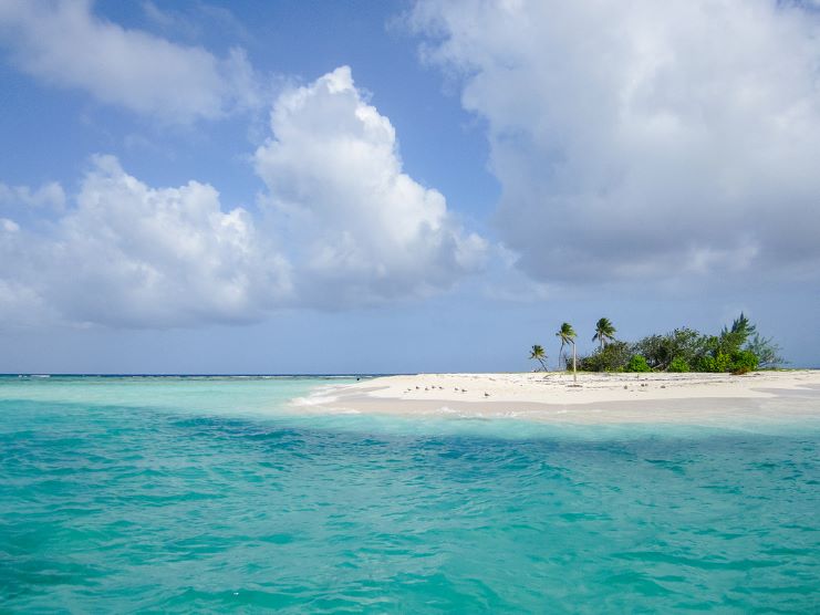
Palominito is a white sand spot with palm trees and pristine blue water.
It is one of 10 small islands and keys comprising the La Cordillera Natural Reserve.
The tiny island is perfect for snorkeling, swimming, spending a day at the beach, or participating in water sports.
The Island is also very popular with the local boating crowd.
Some snorkeling tour companies operating from Fajardo make stops on or near Palominitos.
Do you remember the movie Pirates of the Caribbean on Stranger Tides? They filmed the part where Penelope Cruz’s character leaves Captain Jack Sparrow on a tiny deserted island at Palominito.
Palominito is worth visiting if you are a beach lover!
The white sand beach and the clear blue waters will make you want to return to the small paradise.
Check out Palomino Island in the following video:
There are no direct tours from San Juan to Palominito. You will have to drive from San Juan to Las Croabas in Fajardo. That would be an hour and ten-minute drive.
You can take a water taxi from Las Croabas in Fajardo to Palominito or book a tour of several natural reserve keys, including Palominito.
Below is a Google Map that shows the location of Palominito:
Icacos
Cayo Icacos (Icacos Key) is the largest of the ten small islands and keys of The La Cordillera Natural Reserve.
Icaco’s Island is a small uninhabited island close to Fajardo.
The Island gets its name from the Icaco (Chrysobalanus icaco) cocoplum or paradise plum trees abundant on the island.
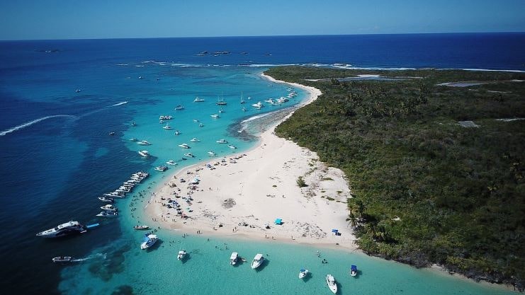
Icacos Island has white sand and one of the most beautiful shades of turquoise water in all of Puerto Rico.
The landscape of Icacos is simply breathtaking.
The best beach in Icacos is in the west part of the island.
For those who like to snorkel dive, go to the rocky part of the beach, where you will see many different fish species.
Check out Icacos Island in the following video:
To get to Icacos from San Juan, you must drive to Fajardo’s Marina Del Rey and, from there, book a tour of the small island.
If your budget allows you, we recommend you take a catamaran tour.
Below is a Google Map that shows the location of Icacos Island:
Read more in our guide to the 10 Best Catamaran Tours In Puerto Rico.
Caja de Muertos
This small uninhabited island’s name could be more welcoming.
Caja de Muertos means dead man’s coffin. But don’t be scared by the island’s name; nothing bad happened there. The name comes from the shape of the island.
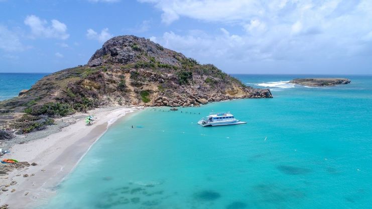
When you see it from the Ponce shore, the island resembles a man lying on his back.
There is a lighthouse remains in Caja de Muertos that you can visit.
Caja de Muertos is a natural reserve for beach and nature lovers. On the small island, you will find clear aquamarine waters, hiking trails, bird watching, and excellent places to snorkel and swim.
Caja de Muertos Pelicano’s Beach is famous for receiving the first Blue Flag Award for a Natural Reserve in the Caribbean.
Below is a video showing Caja de Muertos:
Scuba Divers will love the Vereda Submarina, a Submarine Trail with 25 educational stations informing about the diverse marine life on the island.
If you want to visit Caja de Muertos from San Juan, you will have to drive an hour and a half to Ponce, and from there, you book a tour of the island.
The diversity of marine life, the dry hiking trails, the birds you will see, and the beautiful waters of the Caribbean make the trip from San Juan to Caja de Muertos worth it.
Caja de Muertos is just eight nautical miles off the coast of Ponce. The Island is just 1.5 miles long by half a mile wide at its widest point.
Below is a Google Map that shows the location of Caja de Muertos:
Suppose you want to enjoy other beaches on the Caribbean Sea in Puerto Rico. In that case, you can read our article 11 Best Beaches in Cabo Rojo.
Mona
Isla de Mona (Mona Island) is the third largest island in the Puerto Rican Archipelago, next to the main island of Puerto Rico and Vieques.
People call this uninhabited natural reserve the Galapagos of the Caribbean.
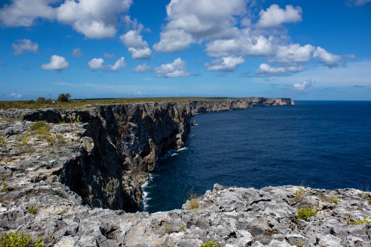
Mona Island has crystal clear water, coral reefs, high cliffs, diverse marine life, and some white-sand beaches.
You will find that Mona Island has a lot of caves, historically significant sites, and endemic plants and animals.
The island is six miles long and four miles wide.
Mona Island is famous among hunters, scuba divers, fishermen, and nature lovers. On Mona Island, people hunt wild boar and goats with firearms, bows, and arrows. Fishermen find a variety of sport fish near Mona Island’s water.
All these things sound great on paper, but you should know that Mona Island is only for some.
A visit to Mona Island is not a day at the beach. On the island, you will find no lodging, potable water, nothing to eat, medical care, or cellular service. You must pack everything to stay on the island and plan for every imaginable situation.
Mona Island has some dangerous conditions. There are poisonous trees/plants and cacti with spines or thorns. The ground has sharp rocks and holes where you can trip.
Mona’s arid climate has ever-present sun and heat. Temperatures are in the high-80s to mid-90s making dehydration, heat exhaustion, and heat strokes possible.
Below is a video trip to Mona Island:
Mona Island is 45 miles west of Mayaguez.
Getting from San Juan to Mona is a challenging task.
First, you have to drive to Mayaguez (that would be two and a half hours), and provided that you get permits to stay on the island, you must book a boat to take you through the rough waters of the Mona Channel.
Below is a Google Map that shows the location of Mona Island:
You can camp in Mona from May through November.
The Government allows hunting from December through April to control the population of non-indigenous goats and pigs.
You can get a three-day camping permit, a one-day visitor’s permit, or a hunting/camping permit.
For more information and to ask for permission to access Mona Island, you can call The Department of Natural Resources of Puerto Rico at 787-999-2200 ext 2100.
Is Mona Island worth it? If you are a nature lover and are physically fit for the trip, yes, it is worth it.
Gilligan’s Island
Cayo Aurora, Aurora Key, is a beautiful, family-friendly mangrove island on the southwest tip of Puerto Rico.
Gilligan’s Island is famous for snorkeling, swimming, kayaking, and having an unforgettable day at the beach. The crystal clear waters and the mangrove offer an opportunity to see the island’s fish and coral.
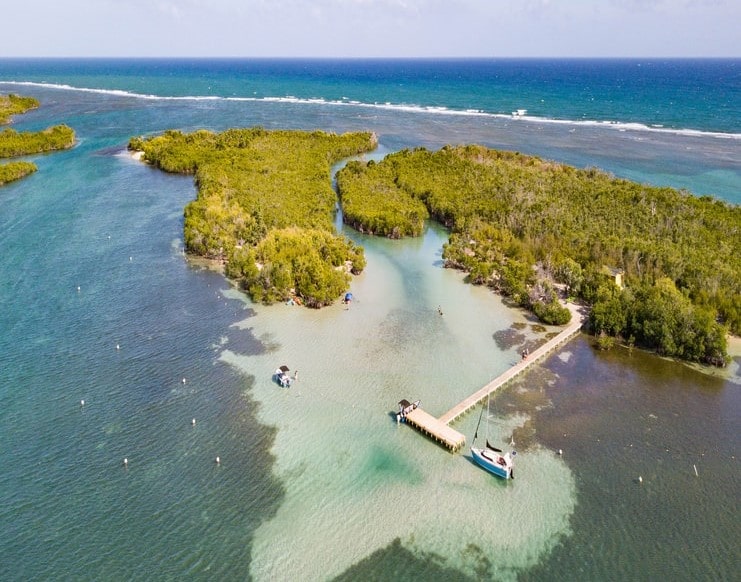
There is a gentle current that takes you on a ride along the west part of the island.
You will find Gilligan’s Island just a few miles off the coast of Guánica.
To get to Gilligan’s Island from San Juan, you must drive to Guánica for two and a half hours.
Once in Guánica, several boats will take you to Cayo Aurora.
Remember that they limit the number of people they allow on the island, so you must be there early.
Gilligan’s Island is worth the long drive from San Juan; you will be on a noncrowded beach with crystal-clear water and lots of marine life.
Below is a Google Map that shows the location of Gilligan’s Island:
And since you took the drive from San Juan, you can book a trip to La Parguera Bioluminescent Bay nearby.
Mata La Gata
Mata La Gata in Lajas is a red mangrove and coral island measuring only 1,500 feet by 1,200 feet.
The Department of Natural Resources of Puerto Rico administers Mata La Gata built a boat dock and picnic tables. The island has a small beach area with white sand.
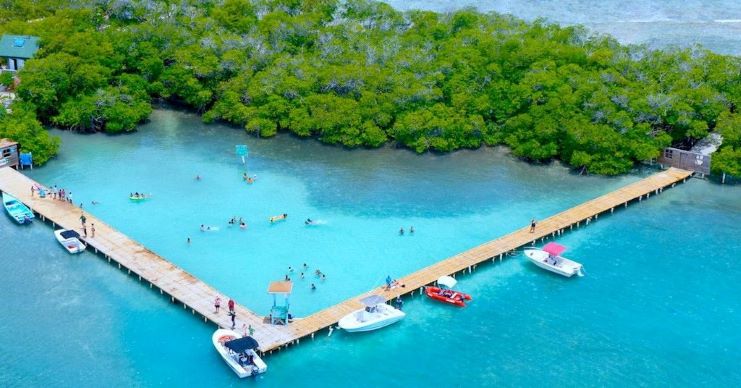
The Government enclosed an area of the calm ocean and made an ocean pool.
To get to Mata La Gata, you must book a boat to take you, or you can take a kayak and paddle to the Island.
Below is a Google Map that shows the location of Mata La Gata Island:
Desecheo Island
Last but not least is Desecheo Island.
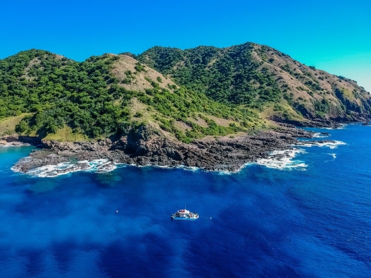
You can see Desecheo Island from the northwest towns of Aguadilla, Aguada, and Rincón.
Desecheo is excellent for scuba diving, sport fishing, and whale watching.
I’ve been to Desecheo countless times and can tell you it is worth it.
Here is a video of a diving trip at Desecheo Island:
To go to Desecheo from San Juan, you must drive to Aguadilla or Rincon and book a boat to take you to the small island.
Below is a Google Map that shows the location of Desecheo Island:
Check out our 30 Best Scuba Diving Sites guide for more information.
FAQ section
How many islands are there in Puerto Rico?
The Puerto Rico archipelago has one main island (Puerto Rico), four small islands (Vieques, Mona, Culebra, and Desecheo), and over a hundred minor keys and islets.
Which Island in Puerto Rico is best?
Besides the main island, Culebra is the best island in the archipelago. Playa Flamenco is worth the visit!
Final thoughts
Puerto Rico is an archipelago with over 140 islands, keys, and islets.
These islands offer a lot of activities for nature lovers.
Visit the Islands of Puerto Rico.
While you plan your trip, check out our article on Best Places & Areas to Stay in Puerto Rico.

