
Quick answer
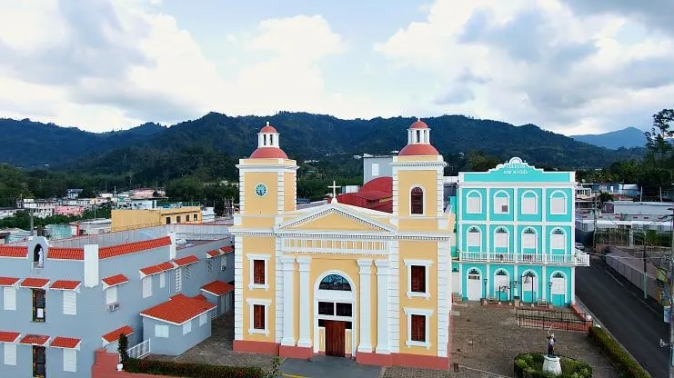
Utuado is a large mountain municipality in Puerto Rico’s Cordillera Central, north of Ponce and south of Arecibo. Its name comes from the Taíno word otoao, roughly “between mountains,” and only Arecibo and Ponce cover more land.
- Population: 28,287 (2020 Census).
- Nicknamed Ciudad del Viví after the river that flows on to Lago Dos Bocas.
Utuado is a mountain town in the middle of Puerto Rico, about an hour and a half by car from San Juan. People come for three things: the Taíno ball courts at Caguana, guided cave-and-river tours on the Tanamá, and Lago Dos Bocas, a reservoir wrapped in green hills. It works as a long day trip or a quiet night or two in the Cordillera Central, and you will need a car.
Utuado at a glance
| Where | Central mountains: Arecibo and Hatillo to the north, Adjuntas and Ponce to the south, Lares to the west, Ciales and Jayuya to the east |
| Size | 113.53 square miles of land, the third-largest municipio after Arecibo and Ponce |
| People | 28,287 at the 2020 Census; the Census Bureau estimated 26,894 in July 2025 |
| Name | From the Taíno otoao, usually read as “between mountains”; locals also call it Ciudad del Viví after the Viví River |
| From San Juan | About 107 km (1 h 30 min) from Old San Juan and 115 km (1 h 35 min) from the SJU airport, with no traffic |
| Nearby | Jayuya about 28 min, Arecibo about 31 min, Ponce about 40 min |
| Top sights | Caguana Ceremonial Indigenous Park, the Tanamá River caves, Lago Dos Bocas, Río Abajo State Forest |
Drive times are free-flow estimates from OpenStreetMap routing. Mountain roads here are narrow and full of curves, so leave extra time and drive them in daylight.
Where is Utuado?
Utuado sits in the Cordillera Central, the range that runs down the middle of the island. The municipio is split into 24 barrios around a small downtown, the pueblo. Two branches of the Viví River, one coming from Adjuntas and one from Jayuya, join near town and flow on to Lago Dos Bocas.
Coffee built the town. By the 1890s Utuado was Puerto Rico’s largest coffee producer, and the slopes are still farm country today. You can learn more about the Taíno people who named the valley, and about the coffee era, in our history of Puerto Rico.
Getting to Utuado
- Drive. Plan on about 1 h 30 min from San Juan. The sights are spread across rural barrios, so a rental car is the only practical way to see them; see our guide to renting a car in Puerto Rico.
- Make it a loop. Arecibo and the north coast are about half an hour away, and Ponce is about 40 minutes south, so Utuado fits neatly into a cross-island drive. Our guide to getting around Puerto Rico covers the options.
Things to do in Utuado
Caguana Ceremonial Indigenous Park
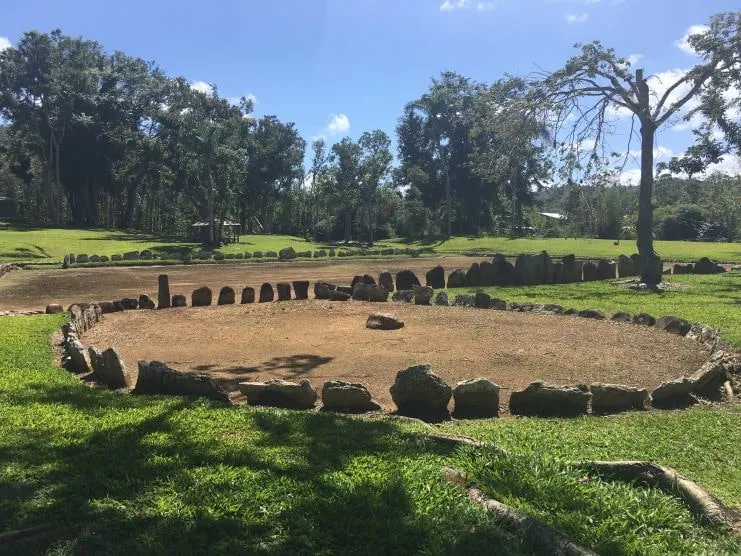
This is the reason many people make the drive. The Instituto de Cultura Puertorriqueña (ICP) has protected the site since 1955. It sits on PR-111 at km 12.4, in barrio Caguana, east of the Tanamá River and about 16 minutes from town. You walk among 10 bateyes, the stone-lined plazas the Taíno used for ball games and ceremonies, edged by upright monoliths carved with petroglyphs.
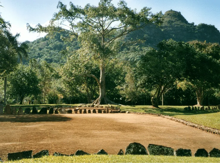
- Hours: when the museum reopened in 2024, the ICP gave daily hours of 8 a.m. to 4 p.m.
- Entry: Discover Puerto Rico lists a $3 ticket that includes the small museum room, with parking on site.
- Museum: the exhibit hall reopened in June 2024 after a renovation of more than $327,000.
- Status: it was added to the National Register of Historic Places in 1992 and named a National Historic Landmark in 1993.
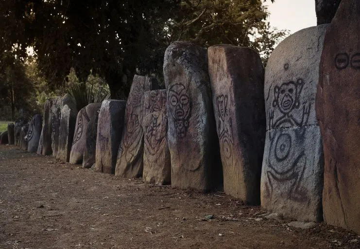
For more sites like this one, see our list of historical sites in Puerto Rico.
Tanamá River caves
The Tanamá River flows through barrio Caguana, near the ceremonial park, and part of it runs underground. Guided tours hike through the forest and farm fields, swim in spring-fed pools and go into caves and caverns. The local operator, Tanamá River Adventures, lists these rules on its site:
- Reservations are required, and every tour starts at 8:30 a.m. There are no afternoon tours.
- Children are welcome from age 8. The weight limit is 240 pounds, and you need to be in good shape.
- Its hiking-and-caving tour is listed at $65 for adults and $59 for children 8–12, and rappelling-and-caving tours start at $95 per person.
Our Tanamá River guide has more on the river itself. For other underground trips, see the best caves in Puerto Rico, and for ideas beyond caves, our outdoor activities in Puerto Rico.
Lago Dos Bocas
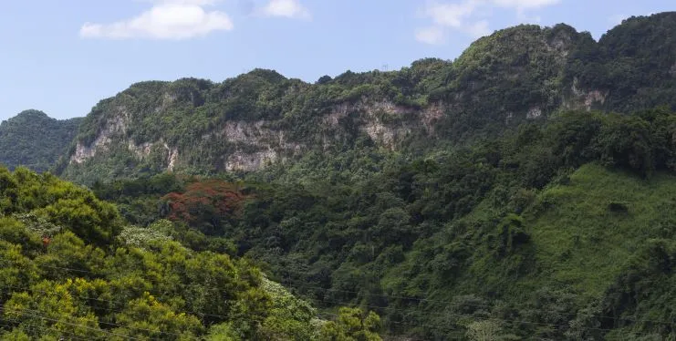
Lago Dos Bocas is a reservoir on the Arecibo River, shared by Utuado and Arecibo. Work started in 1937, and the dam was finished in 1942 as a New Deal hydroelectric project for what is now the Puerto Rico Electric Power Authority. The lake still produces some power and also supplies drinking water to the San Juan metro area.
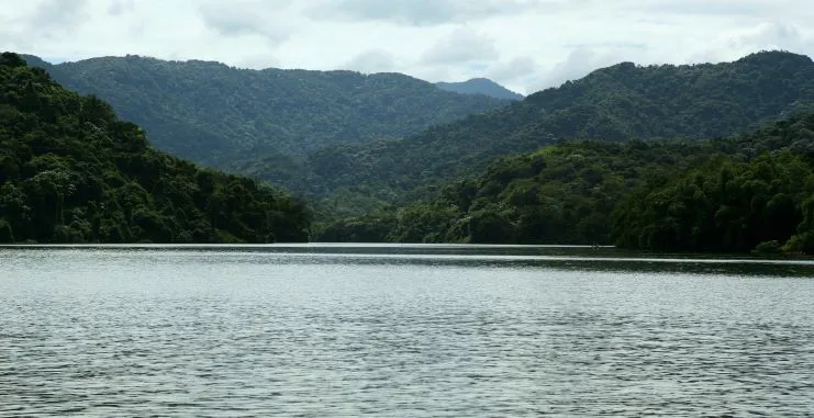
Lunch at one of the lakeside restaurants, getting there by boat, is the classic Dos Bocas outing. Check the boats before you go. In August 2026 three new public boats (the Tanamá, Caguana and Caonillas, about 76 seats between them) arrived at the Embarcadero. They will carry nearby residents and offer eco-tourism rides with stops at lakeside restaurants, but at the time they still needed a Coast Guard inspection before taking passengers.
Río Abajo State Forest
Río Abajo, a state forest shared by Utuado and Arecibo, is one of only three forests where the endangered Puerto Rican parrot lives in the wild. The DRNA runs the José L. Vivaldi Aviary there, a breeding center that has released parrots into the forest since 2006. Hurricane María cost the forest 40% of its wild flock in 2017, according to the U.S. Fish and Wildlife Service. In 2024 researchers counted 230 adults and 70 chicks in the wild, the most since releases began. For trails elsewhere on the island, see our hiking guide.
Coffee and photos
Coffee still grows on these hills. To visit a working farm, compare the options in our coffee tours in Puerto Rico. Between the lake, the ridgelines and the stones at Caguana, Utuado is also a good stop on a photo trip; our best places to take photos in Puerto Rico has more.
Before you go: weather and roads
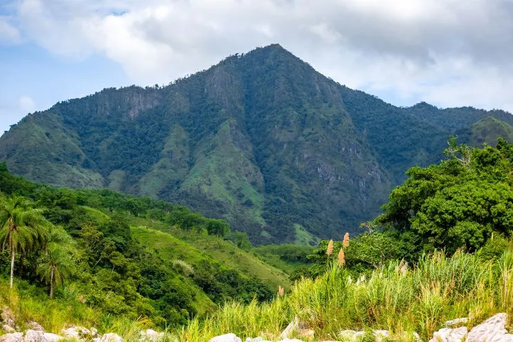
Big storms hit these mountains hard. Hurricane María in September 2017 set off over 70,000 landslides around the island. The U.S. Geological Survey found Utuado the hardest hit: about 40% of the municipio had more than 25 landslides per square kilometer. After heavy rain, check road conditions before you set out, and leave river swims to guided tours.
For general advice, read is Puerto Rico safe? and our things to know before traveling to Puerto Rico.
Is Utuado worth visiting?
Yes, if you want Taíno history, caves and mountain scenery rather than beaches. The ceremonial park, the Tanamá tour and Dos Bocas fill one full day. To see more of the center of the island, sleep nearby and add a second day. Our places to visit in Puerto Rico and things to do in Puerto Rico can help you plan the rest of the trip.
Utuado FAQ
How far is Utuado from San Juan?
About 1 h 30 min by car with no traffic, roughly 107 km from Old San Juan or 115 km from the SJU airport.
Can you see Caguana and the Tanamá River in one day?
Yes. Both are in barrio Caguana. Take the 8:30 a.m. river tour first, then visit the ceremonial park, which stays open until 4 p.m.
Is the Lago Dos Bocas boat running?
Check before you go. New public boats arrived in August 2026 but needed a Coast Guard inspection before carrying passengers.
Frequently asked questions
What does the name Utuado mean?
It traces back to otoao, a Taíno term for a valley, or roughly the land “between mountains.”
How big is Utuado?
It is the third-largest municipality in Puerto Rico by land area, after Arecibo and Ponce, with 28,287 residents in the 2020 Census.
Why is Utuado called Ciudad del Viví?
After the Viví River, whose two branches (from Adjuntas and from Jayuya) meet in town and continue to Lago Dos Bocas.
Where is Utuado?
In the heart of the Cordillera Central. Arecibo and Hatillo lie to the north, Adjuntas and Ponce to the south, with Lares to the west and Jayuya and Ciales to the east.
Sources we checked
Checked in October 2026. Where a fact could not be confirmed against a primary source, we removed it or said so.
Originally published on PuertoRico.com (2023-02-04). Reviewed and updated October 2026: facts were checked against the sources above.